A classic all-mountain ride featuring a rewarding descent with beautiful views over the Gruyères landscapes, achievable in about 2–3 hours (S2+ rating).
The Road
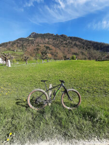
The ride begins at the Broc Sports Center (685 m), where free parking is available, or, for those arriving by public transport, at the Broc-Village railway station (720 m).
The route follows a quiet secondary paved road with a steady gradient, climbing gently to the entrance of the Vallée du Motélon. Continue up the valley to the junction at 1001 m; up to this point, gradients remain below 10%.
After passing a barrier that marks the end of public motorized access, the main ascent begins, immersed in a picturesque landscape of pastures. The paved road continues to Groins-du-Milieu (1348 m). From here, the road alternates between gravel sections and short stretches of concrete or asphalt up to Groins-Dessus (1462 m), where the trail to the Col des Combes begins.
This section is often wet and can be muddy, making some parts difficult to pedal. In good conditions, however, it is usually possible to stay in the saddle up to around 1630 m. The final stretch before the pass inevitably requires pushing or carrying the bike.
Let the Party Begin
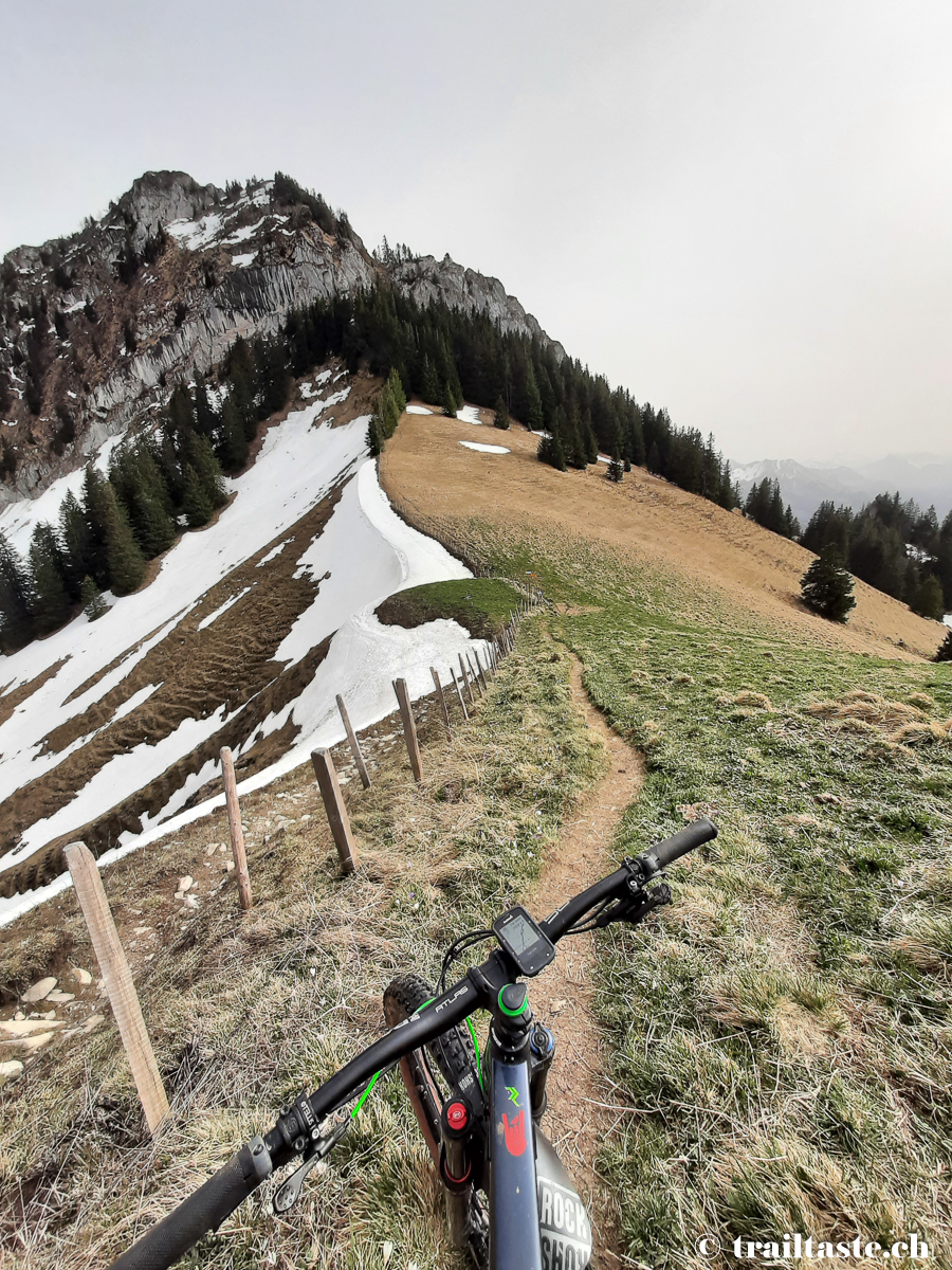
Once at the Col des Combes (1668 m), the descent begins immediately on the opposite side of the pass. The first half of the descent (S3 rating) crosses open terrain through meadows down to approximately 1300 m.
This section features sustained gradients and a surface of loose limestone rock, which increases braking distances. Upon entering the forest, the trail (S2 rating) becomes wider and the descent continues on more moderate gradients. Fallen trees are not uncommon along the route, so caution is advised.
Upon reaching Le Chalet (754 m), follow the paved road down to the river. From there, continue on a gravel road, enjoying the final kilometers of the ride, which lead comfortably back to the starting point.
Trail Notes
Most of the climb faces northeast: snow tends to linger for a long time, especially in the upper section, and there is a good chance of encountering patches of snow even in early summer.
The pastures along the route are generally used only from mid-summer onward, and the fountains are activated around the same time. It is therefore advisable to start with a sufficient water supply and refill at the fountains located in the Vallée du Motélon.
The trail used for the descent is often frequented by hikers heading to the Dent de Broc.
Photo Gallery